Fools Hollow Lake Trail, Show Low, AZ
- Donna Yewchin
- Nov 2, 2020
- 2 min read


Directions: From Fountain Hills, AZ, drive on AZ 87-N through Payson, take a right at the light by McDonald's onto AZ 260-E towards ShowLow. Go 85 miles on AZ 260-E, turn left onto Old Linden Road, driving 3 miles to Fools Hollow State Park entrance on your left.
There is an entrance fee to the park. The day I visited, it was seven dollars.
About the Hike: The trail winds along the shoreline for most of the lake; however, to fully loop the lake requires a bit more navigating than I was up to this day.

You want to park by the boat dock and the bathrooms to begin the 3.2 mile out and back trail. This easy hike has an elevation gain of 73 feet.

It was early morning when I started my hike. The sun was rising over the horizon, resulting in the beautiful reflection in the water.


The Canadian geese were feasting on their breakfast, enjoying the brisk morning temperatures.

A little squirrel scurries across the trail as I approach the first covered fishing pier.
The central part of the lake came into view as I rounded the corner. Lots of different aquatic birds were enjoying the early morning solitude.


The sidewalk starting from the boat dock eventually turns into a smooth dirt pathway leading towards the lake's south end.

Autumn colors popped up along the tributaries coming off of the lake. A sneaky crane was hiding among the tall grass.


A strategically placed bench awaited me to soak in the red, yellow, and autumn colors dotting the landscape.
As I drew closer to the trees along the trail, their vibrant colors brought thoughts to my mind of the quickly approaching Thanksgiving holiday weeks away


Sunbathing ducks huddled together on a little island tucked within the lake's tributaries.

A slight incline along the shoreline led me into a grouping of Ponderosa Pines.


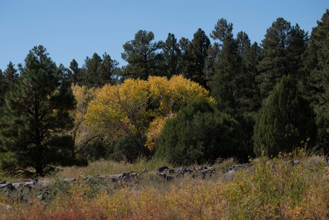
A lovely meadow came into view as I peek through the pines to see where the trail headed. Hiking the outskirts of the field offered beautiful views of the lake.

Stone steps lead you towards the boat rental providing canoe and kayak rentals.

The trail ends a little further up at another fishing pier. You can take the path up the hillside to the campgrounds or turnaround and head back the way you came towards the boat dock.
Arriving back at the boat dock, I decided to continue on a little bit in the other direction. You can find the trail leading in the other direction through the Ponderosa Pines.


The trail leads you down a steep incline to another grassy meadow area.

I found many different wildflowers and berries growing along this end of the lake's shoreline. Even the dried flowers were beautiful in their own right.


As the day rolled on, the lake began to sparkle as the sun rose higher across the horizon.

I followed the trail up through the Ponderosa Pines towards the dam.

Off to the left of the trail is the lake spillway. Hiking to the spillway rewarded me with this stunning view.

Arriving at the dam a little further up the trail, I took a break to enjoy the birds and then headed back towards the boat dock ending my hike at 5 miles total after exploring this other trail.


Comments