Rinconada Canyon Trail, Albuquerque, NM
- Donna Yewchin
- Jun 3, 2021
- 2 min read

Directions: From the Petroglyphs National Monument Visitors Center, follow these directions:
Exit the Visitor Center parking lot and turn right onto Unser Blvd
Drive south 1 mile to St. Joseph Ave
Turn right into the parking lot
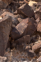
About the Hike: This is an easy 2.2-mile loop trail that is well defined and runs alongside the northern escarpment that resulted from a volcanic eruption over 200,000 years ago. The basalt from this eruption capped the sandstone of the Santa Fe formation. Over time as the sandstone soften, the basalt broke off and tumbled down the hill.


Starting off, we noticed that the trail meandered along the rocky bluff, but we were not sure when we would start seeing the petroglyphs. What we did notice was the sand was getting deeper the further we hiked.

I started feeling anxious to see my first petroglyph, which I did not find until about .05 miles along the path. At the beginning of the hike, petroglyphs were hard to spot; they were sprinkled here and there among the rocks.

Signposts tell you about the Ancestral Pueblo People who carved these petroglyphs. I love learning about how some Native American Indians believe volcanic escarpments are holy places. In contrast, others surmise the Ancestral Pueblo people made these marking to indicate trade routes, marking a specific event, or just communicating through imagery.

Sections of the trail are further from the rocks making it harder to spot petroglyphs. On a sunny day, it's tough to spot them without sunglasses. After the hike, I read about it on https://www.nps.gov/petr/planyourvisit/rc.htm, and they recommended having a pair of binoculars.
When I was reading about the hike on the National Parks Services website, I noticed they also had a hand-drawn map that would have been handy to have before heading out on the trek.

We were able to find the petroglyphs sketched on the trail map, starting with the bird.

Continuing along the trail, we came to another trail marker describing how the Ancestral Pueblo people drew religious symbols, and shortly after that, we came upon a petroglyph.

Rocks closer to the trail were terrific to examine, allowing you to imagine the lava flowing and then hardening into these massive boulders.

Hiking along the sandy trail, it was funny to see this blooming cactus in such an arid environment. Sprinkled through the sand and boulders were tiny seashells and pumice, giving off the feeling that you were walking along a prehistoric sea bed.
We came upon the majority of the petroglyphs after hiking one mile. Below is a sampling of the different petroglyphs we found.
At this point, you have a choice to make, do you continue on the loop which heads out into the desert and does not offer any views, or turn around to wander back along the trailhead along the escarpment searching for more petroglyphs.

Unfortunately, I chose to continue on the loop, realizing too late that I should have turned around and headed back the way I came.


