Massacre Grounds Hiking Trail
- Donna Yewchin
- Mar 19, 2019
- 2 min read

Apache Junction, AZ

Getting there: From U.S. 60 in Apache Junction, exit at Idaho Road and follow State Route 88 northeast for 7.5 miles to First Water Road (Forest Road 78). It's just past Lost Dutchman State Park on the right. Go 0.5 mile on FR 78 to the signed Crosscut-Massacre Ground Trailhead on the right. FR 78 is rough dirt.
About the Hike: This is a 6 mile in and back out trail. The trail has an elevation gain between 2,116 – 3,185 feet. The trail is rated as moderate. In the spring this is a very popular trail on the weekends and after snow or heavy rainfall.

The Massacre Ground Trail is located on the far northwestern edge of the Superstitions Mountain range. It’s suitably named after an 1848 ambush where Spanish miners met their final fate by an Apache war party. Further fueling the Superstition’s legend of ‘There’s gold in these hills”, the story goes that the Indians took the Miner’s horses but left the gold behind.
In late February 2019, I started out early at 6:30 am as the sun was starting to rise. The trail begins with an easy climb along a well-defined path. I saw three mule deer as the trail meandered through grassy meadows. The deer took me by surprise disappointing me that I wasn’t quick enough to snap a picture.

Continuing on I took in the beauty of the town lights off in the distance.
The first mile is an easy ascent through the foothills. The snowy mountain tops frame the teddy bear chollas blanketing the hills below.

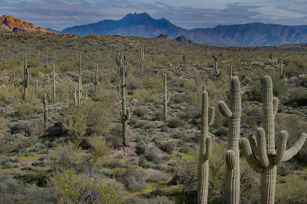
Glancing easterly, as the sun peeked through the clouds, both the saguaro cacti and I watched shifting shadows dance across Four Peaks.
About 1 ¼ mile into the hike the Superstition wildness area starts through the gate.

After going through the gate on the left side of the trail is an outcropping of rocks. The overshadowing clouds painted a sinister beauty upon the rocks from the filtering sunlight.

The trail climbs gently upward along the mountain base.
Pausing and turning around what a spectacular view.


Off to the right, I zoomed in on the dominant conical butte known as Hill 2636.
Twisting and turning through rugged washes, shaded by desert trees and shrubs leads you to this .1 mile slick rock chute. Take your time and make sure you have good hiking shoes.
I always like to glance back to snap a picture, below highlights the elevation gain of this chute.


The route opens into a meadow overshadowed by the Superstition’s camouflaging the waterfall from view.

Continuing along the trail you’ll spot the fall’s off in the distance.

The trail comes to ‘T’ and you’ll go right to the base of the waterfall.


.
Just past the falls, the tiny trail leads up the mesas to the location where the miner’s met their final fate.
Time to home across the Superstition Wilderness.

Wow, back at the parking lot around 9:30 am. I was the 1st car, and now the parking lot is full of cars parked along the road.

On the drive home, I came upon a field covered in wildflowers topping off my day!


Comments